| 1972-1976 | 1990 |
|---|---|
|
Overall |
Overall |
|
Western & Central |
Western & Central |
|
South-Central |
South-Central |
|
Mosaic |
Mosaic |


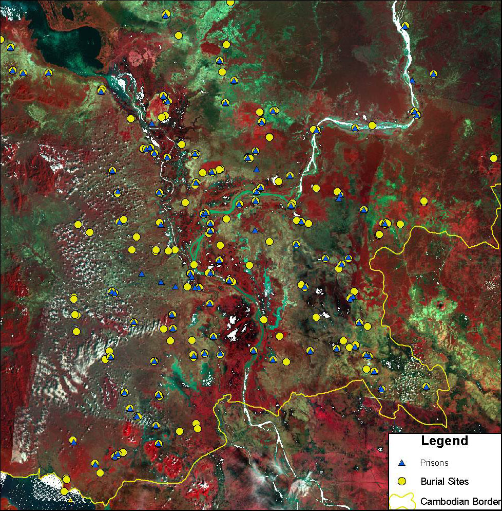
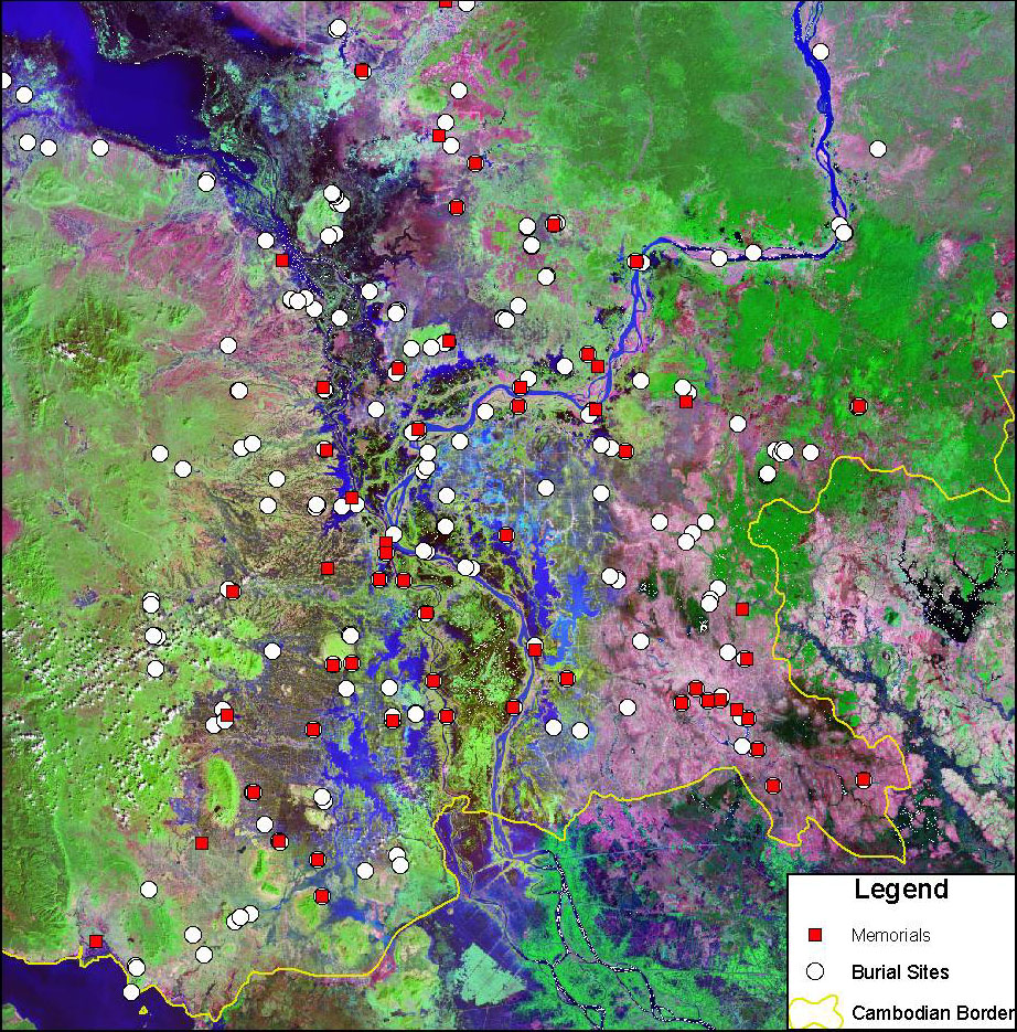
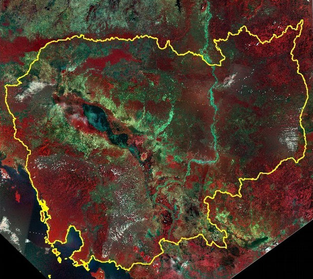
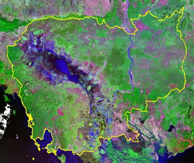
The “1975 Cambodia Mosaic” and related image products on the Genocide Studies Program website were created from 17 Landsat Multi-Spectral Scanner (MSS) scenes collected between December 1972 and January 1976. Scenes for this mosaic were selected based on their availability, date collected (pre-genocide), and image quality (cloud-free and minimal image artifacts). Images were georeferenced to the 1990 era Landsat TM composite created by EarthSat Corporation for NASA (see website referenced below for more information). The horizontal positional accuracy is less than 50 m for the 1990 image mosaic, making it ideal for georeferencing the MSS scenes. Images were mosaicked and color-balanced using ER Mapper software at Yale’s Center for Earth Observation (CEO) by Douglas Morton in July 2002. The final image mosaic is a false-color composite using MSS bands 4, 2, 1 for red, green, and blue, respectively. The original MSS scenes and the full-resolution image mosaic are archived at the CEO.
References:
Center for Earth Observation website: http://www.yale.edu/ceo